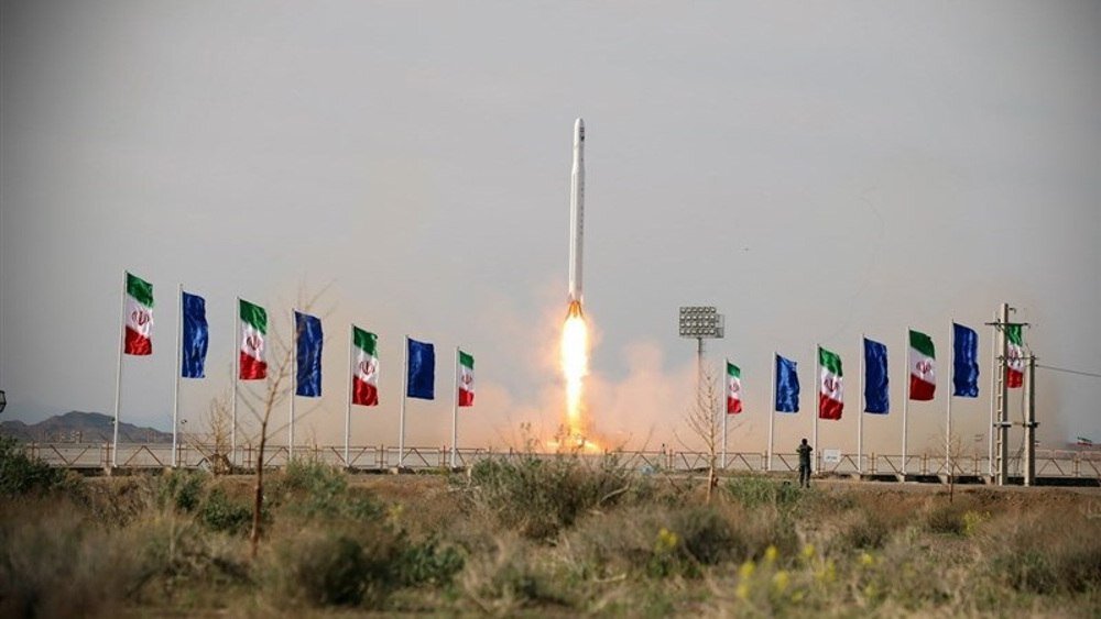
Iran’s successful launch of the Nour 3 imaging satellite
By Faramarz Kuhpayeh
TEHRAN – In yet another technological breakthrough, Iran announced Wednesday that it successfully launched an imaging satellite into orbit, one that would improve Iran’s intelligence capabilities.
The Wednesday announcement by the aerospace division of the Islamic Revolution Guards Corps (IRGC) included details about new Iranian technological advances in the aerospace industry.
The new satellite, Nour-3 (literally meaning light in Persian) was put into an orbit 450km (280 miles) from the surface of the Earth. It was launched by a missile named Qased, which has been used before to carry the two earlier versions of the same satellite into space. The Qased carrier was also developed by the IRGC.
Minister of Communications and Information Technology Issa Zarepour said via X, “With the efforts of IRGC Aerospace Force specialists, a few moments ago, the Nour-3 imaging satellite was successfully placed into a 450 km orbit of the earth with the Iranian Qased satellite carrier.”
“I congratulate all Iranian people, those active in the country’s space industry, and the IRGC’s space experts for this success. God willing, this year will be a fruitful year for the country’s space industry,” he added.
Iranian Defense Minister Brigadier General Mohammad Reza Ashtiani declared last month that at least two domestically produced satellites would be launched into space in the current Iranian year, which will end on March 19, 2024.
“We are involved in the development and launch of satellites. Under our plan, we will have 2 to 3 satellite launches this year, something we hope to be successful,” Ashtiani said.
Iran is among the world’s top 10 countries capable of developing and launching satellites.
The IRGC Aerospace Force sent Nour-2 into orbit using the Qased satellite carrier in March of last year, two years after it launched Nour-1.
Intelligence purpose
General Hossein Salami, the chief commander of the IRGC, said the Nour-3 satellite would be used for intelligence gathering. “We will use the information the Najm satellite (Nour-3) gathers from the earth to meet the intelligence needs of the IRGC,” General Salami said, according to Tasnim News.
Expatiating on the technical aspects of the newly launched satellite, General Salami said the Nour-3 is seven kg heavier in terms of weight than the previous version of Nour-2.
“It has imaging equipment with better accuracy and quality and naturally completes one of the cycles in our satellite chain,” the IRGC chief commander said of the Nour-3.
Two more satellites
The commander of the IRGC Aerospace Force, General Amirali Hajizadeh, offered further details about the functions of the Nour-3, saying that it would be enhanced with two more satellites soon.
“The Nour-3 satellite has both a camera and will be busy collecting signals, and in the near future, we will have a system of satellites in orbit. We will have two more launches by the end of the year,” he said.
On September 3, a homegrown Earth remote sensing satellite had been delivered to the Iranian Space Agency (ISA) and was prepared to be launched into a low Earth orbit (LEO).
The Tolou-3 (Sunrise-3) satellite was given to the state agency by Iran Electronics Industries, a unit of the Defense Ministry.
Tolou-3, with a weight of 150 kilograms, is said to be Iran’s heaviest satellite.
The satellite has a five-meter spatial resolution and can take photographs in black and white. In color mode, it also provides a 10-meter resolution.
Tolou-3 will be launched into an orbit 500 kilometers above the Earth and heavily depends on tools and equipment made by Iranian knowledge-based industries.
Back in August, the ISA chief announced the launch of the production process of “Pars-3”, Iran’s “state-of-the-art and accurate” satellite.
“Previously, we had given some promises about the production of remote sensing satellites with high accuracy,” Hassan Salarieh said.
“Today, I proudly announce that ISA has taken a very important step in the area of designing and producing indigenous remote sensing satellites with very good accuracy,” Salarieh explained.
He mentioned “Pars-2” and “Pars-3” as examples of satellites whose manufacturing has officially started.
Salarieh recognized Pars-2 and Pars-3 as satellites with imaging accuracies of four and two meters, respectively.
The expanding satellites program is part of the IRGC’s plan to shore up its aerospace capabilities, including in reconnaissance areas and intelligence gathering, something that the Nour-3 would best provide.


No comments:
Post a Comment